Bix's Pics

Pictures from a Georgia dad.

Name:
Location: Acworth, GA

Friday, February 24, 2006

Camelback Mountain, Phoenix, AZ

Camelback Mountain (shown as the isolated peak just to the lower right of center in this picture) is a distinct peak of the Phoenix Mountains that offers fairly strenuous hiking, uniquely beautiful sandstone formations, and great views of the sprawl of America's fifth largest city.

The pictures below were taken on my second summit hike via the Echo Canyon Trail. I made the first trip late on a November day, but I was chased back down the trail by a fast approaching lightning storm. I tried again the following morning and was rewarded with some great views, a more leisurely hike, and a lot less people.

Camelback Mountain's profile looking southwest from the intersection of Scottsdale Road and Indian Bend Road in Scottsdale.

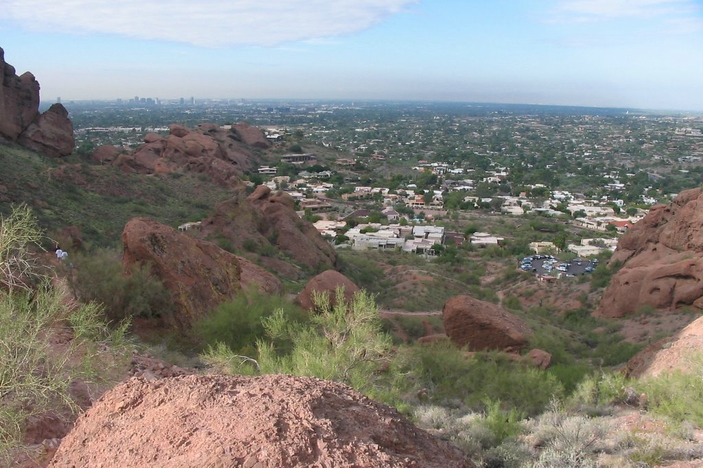
This view looks west down to the Echo Canyon trailhead from the saddle below the camel's head. That small lot in the center right of the picture is all of the parking available on this side of the mountain. Hikers start lining up in their cars (before dawn if necessary) and wait for others to come off the trail in order to get one of the precious spaces. Be aware, the surrounding neighborhoods are NOT the place to park!

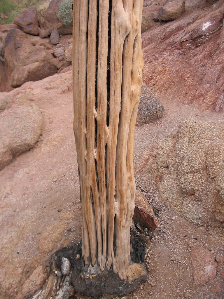
Unique sandstone formations and incredible views are found along the trail in many places.

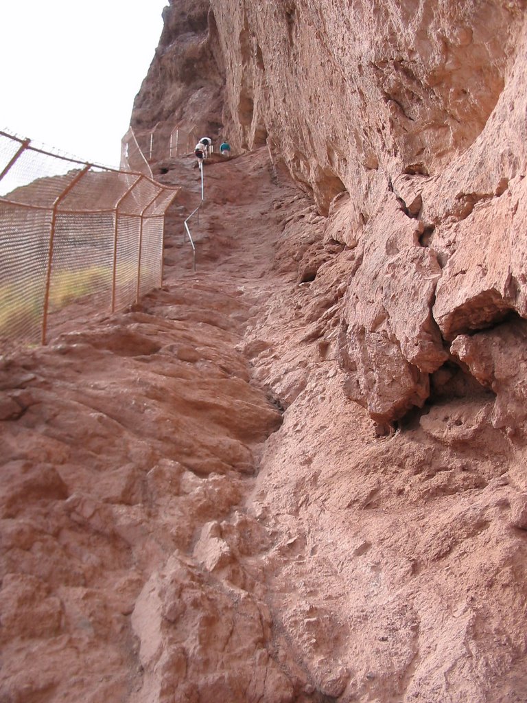
This shot looks up at the first really steep section of the trail. Some people like to walk up this on their own, but many opt for the railing (or the fence) on the left to pull themselves up. The fence is there to keep people from cutting across private property to get to the trail.

A view back down the trail from the top of the railing. Believe me, it's a lot steeper than it looks.

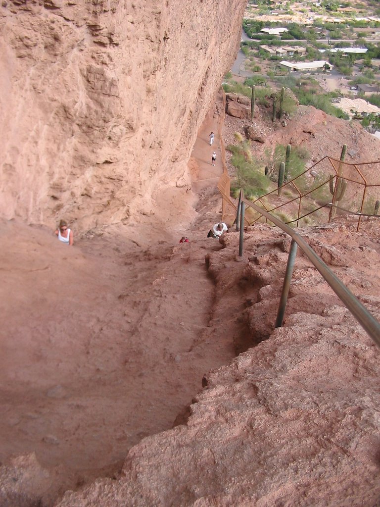
This is the view back down the trail from the top of the second steep section. The top of the first railing is visible at the base of the rock face in the center background.

Onward and upward: After scaling the two steep sections, you then get to rock-hop up this small gully!

I never knew what the inside of a cactus looked like. Now I know.

Warmed up on the small gully? Good, now it's time for some serious rock-hopping!

At the top! This view looks west towards downtown Phoenix, which is visible on the far left side of the picture.

Looking southeast at a clearing storm from just below the summit. This is the remnants of the storm that chased me off the mountain the day before this hike.

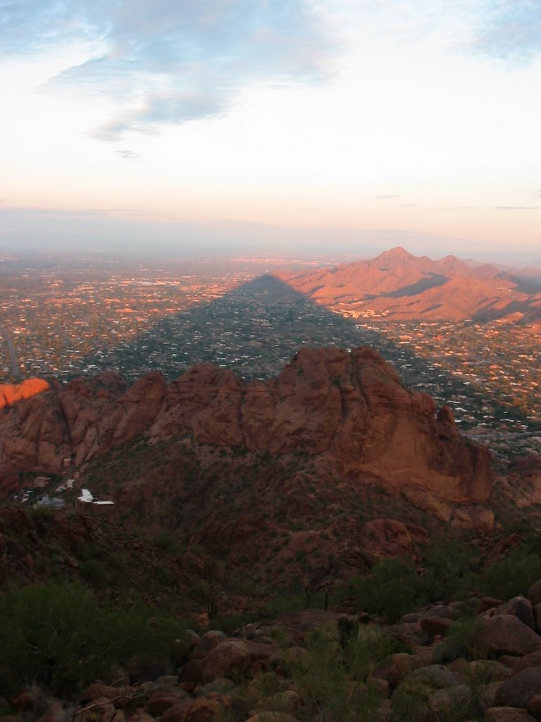
Looking northwest at Camelback Mountain's summit shadow at sunrise.

This is a sunrise view from just below Camelback's summit at Piestewa Peak (on the left) and other peaks in the Phoenix Mountains Preserve.

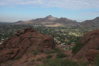
Another view of Piestewa Peak, renamed in 2003 to honor Army Pfc. Lori Ann Piestewa.

All pictures in this post were taken with a 2.0 megapixel Canon Powershot A60 on November 11th, 2004.

Sunday, January 29, 2006

Sope Creek, Cobb County, GA

Sope Creek is part of the Cochran Shoals Unit of the Chattahoochee River National Recreation Area in metropolitan Atlanta, GA. This unit is located near some of the nicest and most expensive homes in eastern Cobb County, but as you utilize the various trails in the park, sometimes the only thing that reminds you that you are in the middle of a city is the number of people that you encounter (well, another reminder might be the parking fees - plan on spending about $3 for the day). Parking is tight, and there are an abundance of "No Parking" signs along all of the nearby roads. Suggestion: take these signs seriously, especially along Columns Drive!


My daughters playing in Sope Creek. On this day, we started at the Sope Creek parking area off of Paper Mill Road and walked about a 1/2 mile along the trail to the creek and the paper mill ruins.


Sope Creek just above the Paper Mill Road bridge.


Sope Creek just below the Paper Mill Road bridge. The mill ruins are along this portion of the creek just out of the picture on the left, and further downstream on the opposite bank.


The stone ruins of the Marietta Paper Mill, burned to the ground by Sherman's troops in July, 1864.


If you hike along the creek, keep an eye out, but it might not be what you think...

All pictures in this post were taken with a 2.0 megapixel Canon Powershot A60 on May 23rd, 2004.

Wednesday, January 25, 2006

Providence Canyon State Park / Westville, GA

Providence Canyon State Park is a geological oddity located in southwestern Georgia, near the town of Lumpkin. The park contains 16 colorful canyons, some as deep as 150 feet, and over 10 miles of hiking trails. Known as Georgia's "Little Grand Canyon", the canyons were formed in the mid-1800's from erosion caused by the poor farming methods employed by local residents.


There are a number of overlooks that can be easily accessed by a rim-top hiking trail, or from parking spots along the park road.


For some scale, there are four people at the overlook in the middle of this picture (look near the "point" of the red cliff).

**************************************************************
Westville, also located near Lumpkin, is a unique living history museum that allows you to visit a western Georgia town just as it was in 1850. All of the buildings have been collected from throughout Georgia and Alabama and relocated to the town site.

(More fun with software - this time I took my digital pictures, added sepia and made them grainier to give them an "old time" look.)


This building is set up as a two-story schoolhouse.


The McDonald house, an impressive antebellum residence.


The Chattahoochee County Courthouse.


A board frame residence.


The oxen-powered cotton baling press. I probably could have told you that this was an authentic late 1800's photograph if it weren't for the stylish fleece vest my sister is wearing...

Unfortunately, Westville was closed the day we visited (d'oh!), so we weren't able to see any of the townspeople. We are planning a return trip later this year, so I'll post more pictures at that time.

All pictures in this post were taken with a 2.0 megapixel Canon Powershot A60 on December 28th, 2004.

Wednesday, January 18, 2006

Moses H. Cone Memorial Park, Blowing Rock, NC

Just getting my blogging feet wet, but my goal is to make this a picture blog first and a place for random thoughts second (maybe even a distant second). I've still got lots of pictures to sort through, work tasks to attend to, teenagers to pick up and drop off and pick up and (well, you probably know the drill), so posting will be a bit sporadic for a while...

In the meantime, here is my first picture post. These pictures were taken at Moses H. Cone Memorial Park (click here too!), along the Blue Ridge Parkway outside of Blowing Rock, NC. Enjoy!


Trail riders with the Cone mansion, Flat Top Manor, in the background.


A view of Grandfather Mountain looking south from the Flat Top Trail. This trail is part of the 25 miles of carriage trails used by hikers, joggers, and horse back riders (sorry, no bikes allowed).


Boone, NC looking northwest from the Flat Top Mountain lookout (Oops, I left the UV filter back at the house...).


Strange mushrooms growing on the side of a tree.


The Flat Top Trail approaching the Blue Ridge Parkway about 1/2 mile from the Cone mansion.


Fun with software: I took the color picture of this old, rotted fence post on the hike, then copied and filtered it in black & white and in sepia using Picasa.

**************************************************************


Ahh, our base of operations in North Carolina, aka "The Mountain Retreat", nestled in the foothills of the Blue Ridge Mountains. Look, Poppy's new workshop is beginning to take shape!

Thanks for stopping by! More pictures to come!

All pictures in this post were taken with a 6.3 megapixel Nikon D50 Digital SLR on September 9th, 2005.

Labels: , , , ,